Our site at Horse and Groom is now over, but we still have
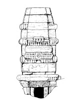
plenty of work to do. One job is to create elevations of all the walls of the
medieval buildings. These will be used to illustrate the final report, but most
importantly they form a key part of our record of the site. We are using a
technique called photo-rectification as it is a quick and effective method that
takes less time on site, but still allows for accurate results.
 |
| Lee fixing targets to the walls using a glue-gun |
Reflective targets (Ground Control Points) are fixed to the
structure and the precise location of each target is recorded in 3-D using a
Total Station/reflectorless EDM. These target positions are imported into a CAD
or GIS program where they create a 3-D scaled frame to which the photographic
images will be calibrated.
A series of photographs are taken of the structure -making
sure that several targets are in each image and that the images are taken
angled square on to the structure in order to reduce image distortion. Overlapping
images are taken to further reduce image distortion, and an overcast day is
best as this eliminates shadows in the images. A record sheet is filled out for
each photo-rectification job, listing the photo and target numbers, and a
sketch of the elevation showing target locations and context boundaries. These
record sheets are essential as they give the person processing the jobs all the
information in one place.
Where necessary the photographs are ‘stitched together’ to
create a single image and are then imported into the CAD or GIS program where
they are stretched or ‘rubber-sheeted’ to fit the targets. This creates a scaleable
image which can then be manipulated to allow scale elevations and plans to be made
by tracing the outline of the walls and individual stones.
For our site rectified versions of the AerialCam overhead photos will be used to
add stone-by-stone detail to the plans of the medieval buildings, whilst rectified side-on photographs
of each wall will allow detailed stone-by-stone elevation drawings to be
created. Additional hand-drawn elevations and plans were taken as required to
fill in any gaps in the photo-rectification record.
The process does take time but it’s a lot quicker than
drawing all the elevations by hand at scale, and of course it can be done in
the warm and dry!


No comments:
Post a Comment