Although we finished digging in December 2013 work is far
from finished on our project at Horse and Groom Inn in the Cotswolds. Over the
past few months a team of specialists have been looking in detail at all the
artefacts, animal and human bone and environmental samples from the site, and
writing detailed assessment reports on them. Over at Urban Archaeology we have
also been busy checking and collating records, digitising site plans, briefing
the specialists and creating a database and GIS of all the site data. We have
also been writing a detailed account of what we found at the site, a framework
into which the specialist data will be slotted later. This document, known as a
post-excavation assessment (PXA) is an important milestone in the site's
progress, a point where we stop and assess what we found on site, look at its
potential and its significance, and decide what further work is required to
analyse and publish the site findings.

Back to the City
Back in 2012 Urban Archaeology worked on an evaluation for
LP Archaeology at 100 Minories in the City of London. The site was immediately
outside the Roman and medieval city wall, just north of the Tower of London and
during the evaluation we found evidence for 17th century brick buildings,
gardens and yards, and a very deep
ditch: the 'City Ditch', which was first dug in the Roman period and ran around
the City wall. You can read more about the evaluation here, here, here and here.
After a brief lull the archaeological project has restarted
and we are gearing up for a major excavation later in the year. So far the existing
building has been demolished and we have monitored geotechnical works to find
out exactly where the District Line tunnel runs -it crosses the northern corner
of our site. Now we are starting to go below slab level and get the site ready
for the dig.
We know that on our site the Roman City Ditch has probably
been truncated by subsequent medieval and post-medieval ditches, and the site
may lie outside of the Roman East London Cemetery, Roman remains may therefore be
limited to gravel quarries and agricultural features. By the 1580s mapping
evidence shows the area around the site as small, enclosed fields east of the City
Ditch, but by 1676 the area between the City Wall and Minories had been built
up, with rows of houses and courtyards to the west of the Minories street
frontage, and the ditch appears to have been largely infilled.
There was a major redevelopment of the site in the 1760s and
a major Georgian development was built -The Circus, The Crescent, and America
Square, all linked by Vine Street. Instead of digging deep cellars or basements
the developers demolished the existing buildings and built on top of that level
-then raising the road and back yard areas by up to 3m and effectively
protecting the underlying archaeological remains under the new basements. Much
of the Georgian development was destroyed by bombing in WW2, and our site was
redeveloped in the 1960s by the Guildhall Polytechnic as a school of
navigation.
When the 1960s buildings were constructed they filled some
of the old Georgian basements with mass
fill concrete -up to 3.5m thick! We are now slowly breaking out that concrete so
that we can expose the top of the archaeological deposits underneath. These deposits
will be mapped and protected with geotextile and a layer of clean sand before
the area is covered by a thick piling mat and the piling rig arrives. Once the
pilers have built a pile wall around the excavation we will remove the mat and protection
and have a proper excavation of the site -secure within our pile wall.
The site will be excavated in three areas, starting with the
northern Area A. We dug one test pit here in 2012 and found evidence for probable
gravel quarrying, and medieval or post-medieval yard surfaces -fitting nicely
with the 1676 Ogilby and Morgan map which shows the test pit location within a
yard. To the east and south of the testpit the map also shows a series of
buildings around an alley and courtyard, and we are hoping that these may have
survived the Georgian demolition. At the west of Area A we are expecting the
ground to start sloping down to the City Ditch.
On-line course on 15th century England
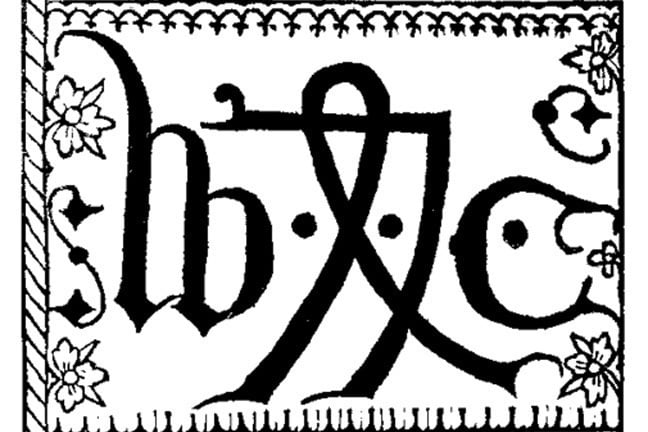 |
| William Caxton's printers mark © Public domain |
The University of Leicester has produced an online learning course
on ' England
in the time of Richard III'; the course is free and available on FutureLearn, an online learning
portal. The course uses a variety of accessible articles, audio files,
animations and videos to take you through the political, economic and social
background to the late 15th century and the discovery of Richard III's body in
a series of short modules. The course is suitable for anyone interested in later
medieval England and assumes no previous knowledge of the subject. It's a great way of learning about a pivotal time in the evolution and history of England, and the modular structure means you can take it at your own speed as and when you want.
The course started a couple of weeks ago, but you can join
in at any time and catch up, it takes about three hours a week over six weeks, although if you
follow all the links and reading it could take far more! Professor Christopher
Dyer, who has helped us with documentary records on our Horse
and Groom medieval farm site, is one of the academics who has contributed
to the course.
Day of Archaeology 2014
It was The Day of Archaeology yesterday, a day when archaeologists are encouraged to blog about what they are doing on the day. It is a fantastic project that gives a real insight into
the huge variety of archaeological work going on around the world, and
the huge variety of people doing that work, so please go and have a look
at what archaeologists have been getting up to.
Unfortunately I can't talk about my current site -the client has asked us not to discuss the site or the findings at this time, so instead I've blogged about the issues of publicity and commercial archaeology.
Hopefully the blog will explain some possible reasons why it has been a bit quiet on here recently, but the good news is that the next project will involve a lot of public information -we are planning a project website and regular updates on what we are digging and finding out about the site. Can't wait!
Unfortunately I can't talk about my current site -the client has asked us not to discuss the site or the findings at this time, so instead I've blogged about the issues of publicity and commercial archaeology.
Hopefully the blog will explain some possible reasons why it has been a bit quiet on here recently, but the good news is that the next project will involve a lot of public information -we are planning a project website and regular updates on what we are digging and finding out about the site. Can't wait!
Medieval cross-slab recording
Recent work has included a research project recording
medieval cross-slabs in local Gloucestershire churches. Cross-slabs are a
relatively overlooked class of medieval funerary monument compared to the better
known and often more magnificent effigy slabs and tombs. Cross-slabs are essentially
characterised by a central cross motif, although there is considerable variety
in their style and decoration, and there is overlap with other types of
monument.
 |
| Cross-slabs, and possible foot-stone, at St Mary Edgeworth. Top row, left to right: incised expanded arm or Maltese Cross in circle on tapered shaft, 12th century; incised simple Greek cross on stepped Calvary; incised composite Maltese and straight arm-cross with ring around shaft, stepped Calvary and Chalice, 14th or 15th century? Bottom row, left to right: incised straight-arm cross with ribbon work and shaft with ribbon work band; incised expanded arm cross with shaft, 12th century; possible foot-stone with crude incised round-leaf bracelet cross, 13th century? |
And now for something completely different: Nubian Royal Cemetery excavations
I’m
swapping medieval settlements for something a bit more exotic for the next few
weeks, I’m off to North Sudan to work on the Nubian royal cemetery site of El
Kurru. The site is on the banks of the Nile below the 4th cataract and is near
to Karima. It contains several eroded pyramids which date from the 8th to the
4th century BCE during the early Kushite period, there are also four rows of
horse burials and rock-cut tombs with wall paintings. The known monuments were
excavated by Reisner in 1918/9 –all but one pyramid chamber which was deemed
too unsafe to enter.
The
International Kurru Archaeological Project (IKAP) is a collaboration
co-directed by Dr Geoff Emberling (Kelsey Museum of Archaeology, University of Michigan),
Dr Rachael J. Dann (University of Copenhagen) and Professor Abbas Sidahmed
Mohammed Ali (University of Dongola, Kareima).
Abbas
Sidahmed, a Sudanese prehistorian who grew up in El Kurru village is in charge
of a project to prepare and present the site for visitors, screening and
removing Reisner’s spoil heaps. Geoff Emberling will be continuing the
excavation of a mortuary temple and an area of “town wall” that Reisner
uncovered and which was relocated last year. Finally his team will be investigating
the burial chamber of the one pyramid which Reisner did not excavate.
 |
View of pyramid and entrance to burial chamber of Pharaoh
Piye (Creative Commons, Bertramz)
|
I will be working for Rachael Dann, and we will be investigating the outlying royal cemetery –following
up on magnetometry survey which revealed some interesting anomalies that may be
tombs that were not found by Reisner. They will almost certainly have been robbed in the past, but may still contain wall paintings and fragmentary evidence of the original contents.
 |
Burial Chamber of the tomb of Tanutamani (Creative Commons,
TrackHD)
|
I’m not sure how good the internet will be out there, so its
unlikely that I’ll be posting any progress reports and pictures before I get back
to civilisation in Khartoum, but who knows!
Evening lectures on the excavations at Horse and Groom Inn, Bourton-on-the-Hill
Over the next few months Chiz Harward will be giving a series of evening lectures on the results of the excavations at Horse and Groom Inn, Bourton-on-the-Hill. The talks will cover the background to the site, the excavation, and the initial findings and thoughts on the site and its importance in understanding the medieval landscape of the north Cotswlds. There will be time for questions and discussion after each talk.
Urban Archaeology excavation factsheets
For a few years Urban Archaeology has been producing factsheets on various subjects from artefacts to excavation techniques. These are now being updated and expanded and over the next few months we will be making the new sheets available online for free dowload.
 |
| Urban Archaeology factsheet: excavating robber cuts |
Photo-rectification
Our site at Horse and Groom is now over, but we still have
plenty of work to do. One job is to create elevations of all the walls of the
medieval buildings. These will be used to illustrate the final report, but most
importantly they form a key part of our record of the site. We are using a
technique called photo-rectification as it is a quick and effective method that
takes less time on site, but still allows for accurate results.
Cold weather working: a survival guide
So far the winter here in Gloucestershire has been mostly mild and wet and very windy rather than cold and snowy, but I thought it worthwhile to repost this piece I wrote for the Diggers' Forum a few years ago. Winter is always a challenging time for those working on site, and with the current gales and wet weather this year is no different and its not likely to get a lot better for a fair while yet. We've put together a few tips for both diggers and supervisors to help you survive the winter –after all, it may keep coming til April!
Cold weather working: a survival guide
 |
| Pretty skies, but can you see what you are digging? |
In the news...

Artefact factsheets update
One of Urban Archaeology’s wider aims is to develop
training materials for use on archaeological sites. For several years we
produced an occasional and ad hoc series of hand-outs and reference sheets for use in identifying finds and aiding in the
recording and interpretation of archaeological features and site formation processes.
A couple of years ago Urban Archaeology applied for grant
funding to develop a series of factsheets based on common classes of artefacts;
unfortunately we weren’t successful however we did prepare a pilot version of a
Roman Ceramic Building Material (CBM) Factsheet containing information on types
of CBM found in London. The concept was for a free downloadable A2 poster that could
be displayed in site huts and tea rooms, with smaller A4 versions available as handouts,
or potentially viewed on smart-phones. There's a downloadable version of the pilot factsheet below -the fonts don't view very well on the Scribd website, so its best to download it and it will open as a pdf.
We’d be very interested in any feedback on the format and the
level of content, especially if anyone is interested in sponsoring or helping
develop what we feel would be a great resource for archaeologists!
Iron Age burial and medieval farming

Since August Urban Archaeology has been working for LP Archaeology
excavating the remains of a medieval farm in a pasture field next to The Horse and Groom Inn, Bourton on the Hill in the Cotswolds. The pub is building a new
car park which needs to be terraced into the hillside and which would remove all
the archaeological remains, so we are excavating these before the ground
reduction.
 |
| Aerial view of the site looking north showing some of the medieval farm buildings |
Trial trenches in 2011 showed that there was a varied range
of remains on the site: a large Iron Age ditch, a Roman pit containing building
rubble and grain-processing waste, medieval pits and postholes, and the remains
of at least one stone-built medieval building. However when we stripped the site
we hadn’t really expected to find an almost complete ground plan of a medieval
farm, with nine rooms -each measuring approximately 5m by 5m- and with some
walls surviving to 1.2m in height.
Construction, demolition and recycling in the Cotswolds
We can tell a lot about the medieval buildings on our site at
Horse and Groom Inn from the physical remains that survive, but there are also
other clues to the appearance of the buildings, some of which can be inferred
from what is not there, rather than
what is.
Bourton on the Hill medieval building: Room F fly-through
We've been using photogrammetry to record parts of our medieval farm site at Bourton on the Hill. This computer-generated animation of the small room featured in our last blog post was produced using photogrammeric techniques.
Photogrammetry is an established archaeological recording technique and uses photographs to create reconstructions of buildings, structures and sites. In traditional photogrammetry fixed 'targets' are used as reference points to 'stitch' the photographs together and 'rectify' them to the correct scale and viewpoint. Increases in computing power have led to computer-based photogrammetric programs that can combine many digital photographs to create 3-D models of the subject without the need for targets. The models can be rectified (scaled and located spatially) so that we can then produce scale 2-D drawings from the 3-D model, these drawings are then used in the post-excavation work and as illustrations in the final published report.
Subscribe to:
Posts (Atom)


 Posts
Posts